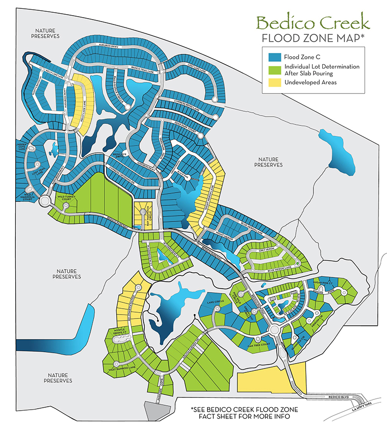
Because our master planned community is so large and full of diverse geography, we provide our homeowners and potential home and lot buyers information about flood zone designations in our community. You can click on the image below to see an official flood zone map of our community. We have also listed flood zone facts below for your information.
Bedico Creek Flood Zone Fact Sheet
Bedico Creek Was Deemed Out of the Flood Zone by FEMA.
The New Map Changes Positively Impact Bedico Creek!
Land Elevations in Bedico Creek Are at 18 Feet to More Than 25 Feet Above Sea Level.
All Lots at Bedico Creek Preserve Are in One of the Following Categories Listed Below
- Lot is NOT in a flood zone.
- Most Bedico Lots are in an area designated by the Army Corps of Engineers to be out of a flood zone, according to the new flood maps. Therefore, upon St. Tammany Parish’s acceptance of the new flood maps, Flood Zone C will take effect.
- Until the new maps are adopted FEMA will allow each lot (or home) to be removed from Flood Zone “AE” to Zone ‘C’’ via a Letter of Map Amendment (LOMA). This is an easy and inexpensive process.
- The few lots that will remain in the AE zone after the new maps are adopted are all filled (or need minimal fill) such that, once the home is complete, a LOMA can be filed and it will be removed from the flood zone.
To Summarize the Facts:
All lots in Bedico Creek are either out of the flood zone, will be out once new maps are adopted, or can easily be removed from a flood zone, making flood insurance premiums both an ‘’elective” and “inexpensive” choice.
Catch Up on Houzz!